
The Best Day Hiking In Yosemite Valley – Parked In Paradise
Yosemite National Park in California is one of the most stunning parks in the country. It is renowned for sights like the magnificent Yosemite Falls, and the steep granite cliffs of Half Dome.
Yosemite Valley is the heart of the park, and one of the premiere hiking spots America’s west. There are routes for every season, spanning from short and sweet treks to challenging multi day hikes.
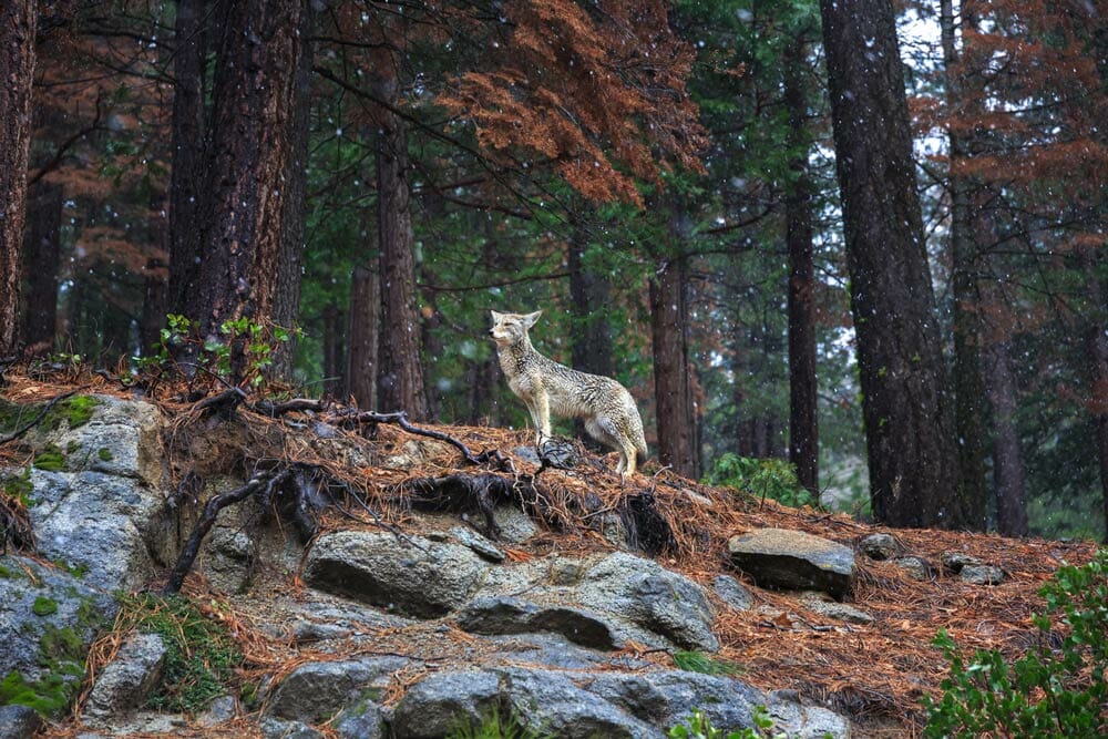
Along the way a diverse array of animal species can be found. Over 80 mammals live there including black bear, mule deer, mountain lion and marmot. As well as more than 200 bird species like the endangered peregrine falcon, giant gray owls and bald eagles that inhabit the area.
Aside from taking in the views, hiking is one of the best ways to experience Yosemite. There are over 50 marked hiking trails throughout the park for day hiking.
Unlike the campgrounds, there are only 4 trails that close during the winter season: The Mist Tail, John Muir Trail, Half Dome Cables and the Four Mile Trail. The rest of the trails are open for adventure year-round.
Yosemite Valley Day Hikes
| Trail | Distance (round-trip) | Difficulty | △ Elevation Gain |
|---|---|---|---|
| Happy Isles | 0.5 mi | Easy | 10 ft |
| Bridalveil Fall Trail | 1 mi | Easy | 80 ft |
| Lower Yoesmite Fall Trail | 1 mi | Easy | 50 ft |
| Mirror Lake Trail | 2 mi | Easy | 100 ft |
| Sentinel/Cook’s Meadow Loop | 2.25 mi | Easy | 10 ft |
| Turtleback Dome | 1.2 mi | Easy | 360 ft |
| Artist's Point | 2 mi | Easy | 500 ft |
| Vernal Fall Footbridge | 1.6 mi | Moderate | 400 ft |
| Inspiration Point | 2.6 mi | Moderate | 990 ft |
| Columbia Rock | 3 mi | Moderate | 1,000 ft |
| The Mist Trail | 3 mi | Moderate | 1,000 ft |
| 4-Mile Trail | 9.6 mi | Strenuous | 3,200 ft |
| Pohono Trail | 13 mi | Strenuous | 3,700 ft |
| Snow Creek Trail | 9.4 mi | Strenuous | 2,700 ft |
| Upper Yosemite Falls Trail | 7.6 mi | Strenuous | 2,600 ft |
| Half Dome | 15.35 mi | Strenuous | 4,800 ft |
Happy Isles Hike
Total Distance: 0.5 miles
Estimated Time: 15 minutes
Elevation Change: 10 feet
Difficulty Rating: Easy
This short hike near the end of the valley is just a half-mile round trip with little elevation gain, making it easily doable for most. While crowds are steady, they aren’t overwhelming and you’ll be able to explore a pair of islands in the Merced River, which serves as an ideal place to cool off from summer’s searing sun.
During late summer and autumn when the water levels are lower it makes for an especially tranquil walk through the forest, crossing a bridge over the river where it gently tumbles over and around the boulders.
In the middle of spring, snow melt usually causes it to swell with raging whitewater rapids while the dogwood trees look especially picturesque with their blossoms. The dirt trail will lead you to a nature center, open April through October, showcasing interactive displays about natural history and wildlife in the area.
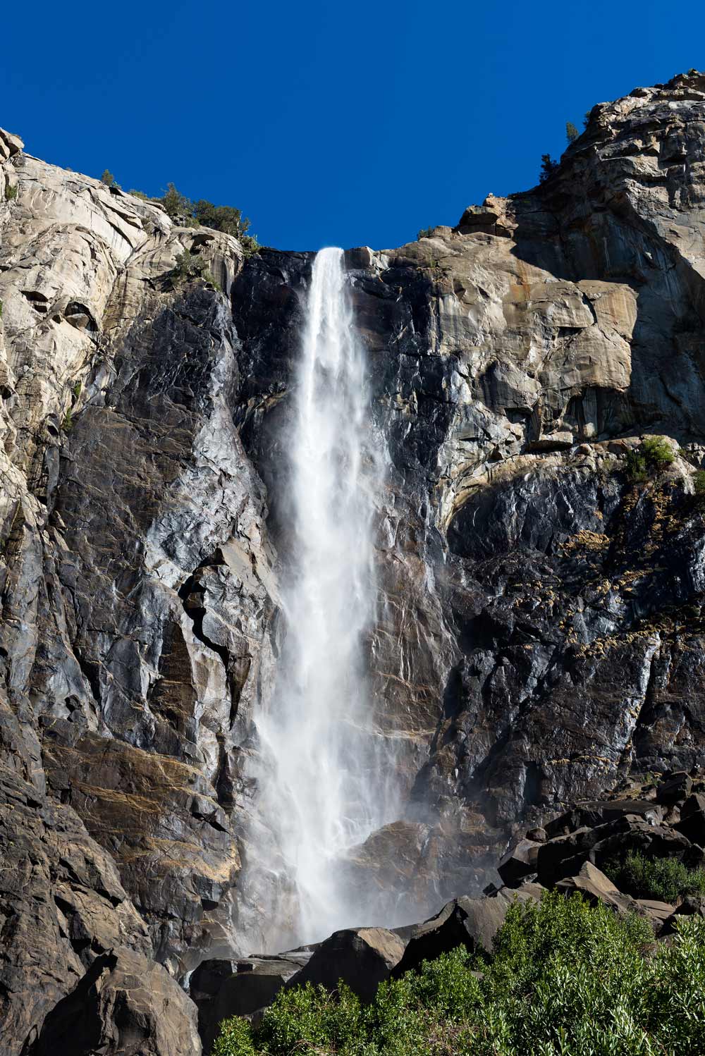
Bridalveil Fall Trail
Total Distance: 1 miles
Estimated Time: 25 minutes
Elevation Change: 200 feet
Difficulty Rating: Easy
One of the most popular hikes in Yosemite Valley is this 1 mile round trip trek that leads to one of the prettiest waterfalls in the park—Bridalveil Falls.
From the trailhead, you’ll be able to see the cascade through a pine forest, plunging 620 feet from a hanging valley. Follow the paved trail from the parking area to the base of the waterfall. While the water is especially powerful in the spring, it flows all year-round. Be extra cautious traversing slippery rocks while approaching.
In the springtime the mist is so heavy and carries so far, you’ll need to wipe off your sunglasses, sometimes from as far as a quarter-mile away. If you’d rather not get wet, wear a waterproof poncho or jacket with a hood on this hike.
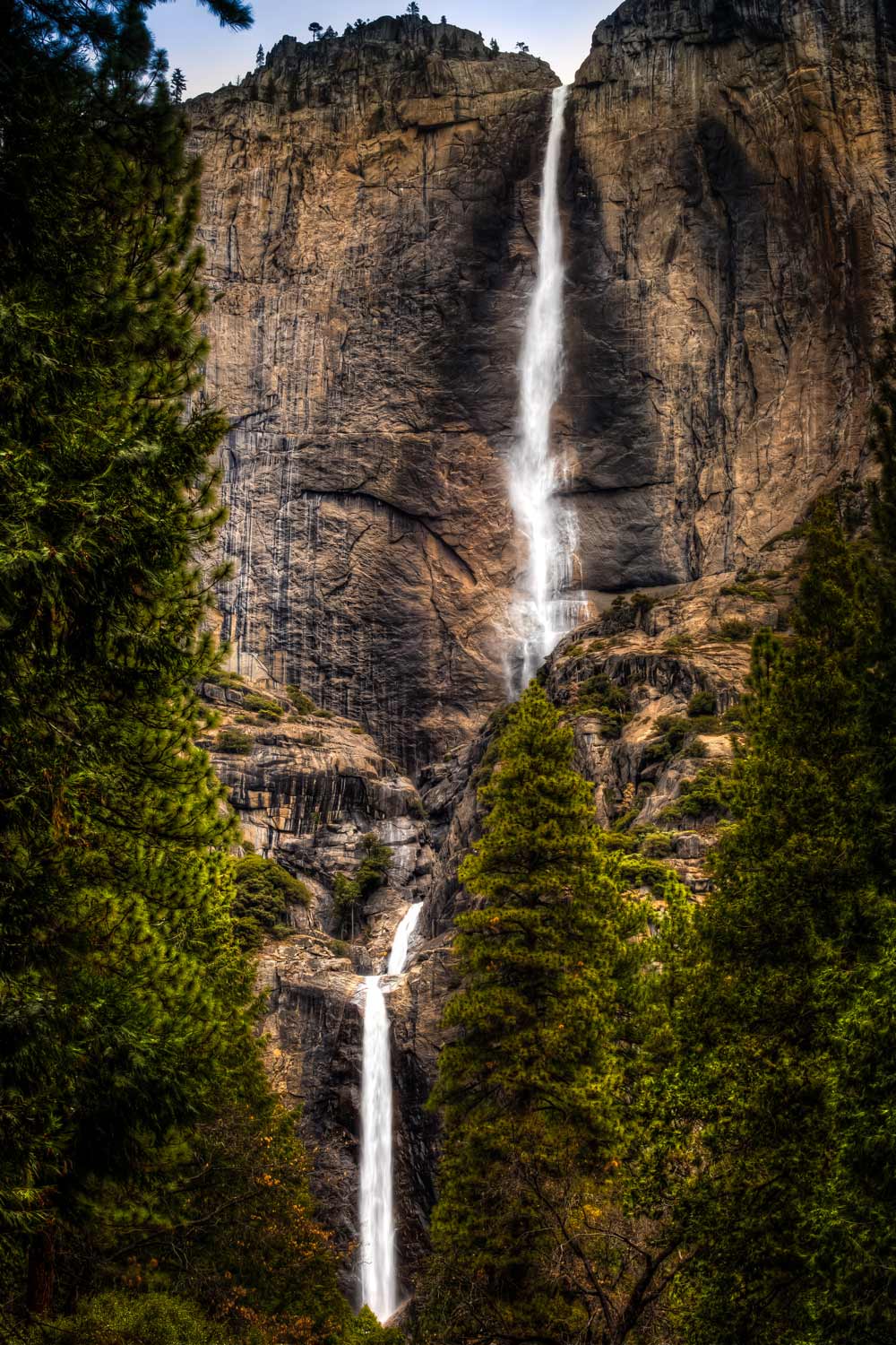
Lower Yosemite Falls Hike
Total Distance: 1 miles
Estimated Time: 30 minutes
Elevation Change: 50 feet
Difficulty Rating: Easy
Yosemite Falls is the tallest waterfall on the continent – 10 times higher than even Niagara. This waterfall is so high that it includes a couple of drops along the 2,425-foot-cascade, the fifth tallest in the world.
Providing a big reward for an easy half-mile round trip jaunt, the water will be flowing at its peak in spring and into early summer, a time when you can expect to get at least a little wet.
If you wait until later in the summer or early fall, you might miss it as it’s often dry. Otherwise, expect to enjoy dramatic views that come both at the start and at the end of the 320-foot-high lower fall. Provided the path isn’t covered in ice or snow, its both wheelchair and stroller accessible, making it popular with hikers of all ages and every fitness level.
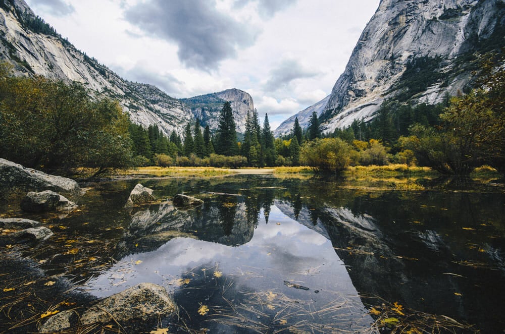
Mirror Lake & Tenaya Canyon Hike
Total Distance: 2.4 miles
Elevation Change: 147 feet
Difficulty Rating: Easy
This route will get you as close to the base of Half Dome as you can get. It’s one of the best ways to capture a photo of its crown reflected in the still waters of what’s referred to as Mirror Lake, which is not actually a lake but a large pool in Tenaya Creek.
Bring your bathing suit and you can take advantage of one of the park’s most popular swimming holes too.
The first mile is all paved, leading straight to Mirror Lake, with a loop trail following Tenaya Creek beyond. The best time to hike it, especially if you want to take a chilly but refreshing dip, is in the spring and early summer when the creek will be flowing freely with snow melt. Exhibits along the way highlight some of the area’s cultural history as well as the lake-to-meadow succession.
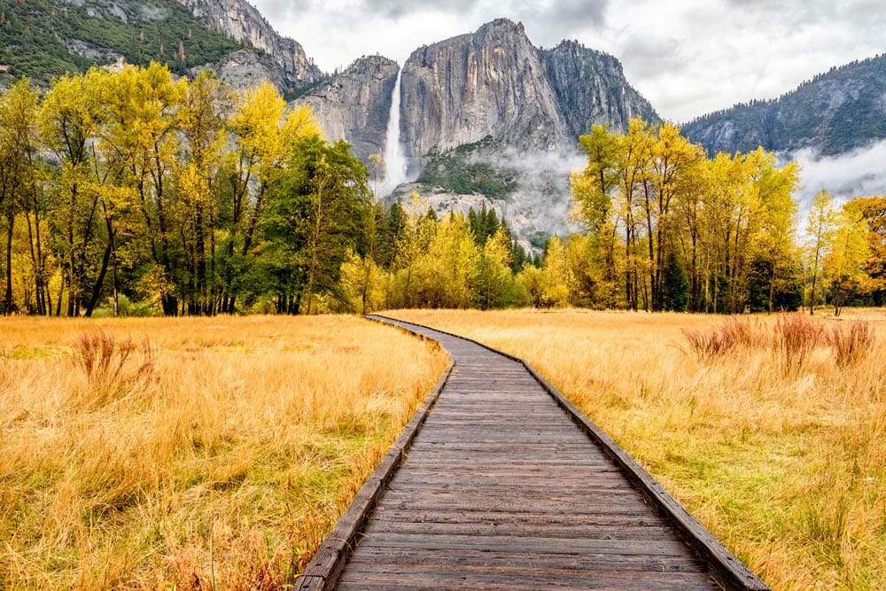
Sentinel and Cook’s Meadow Loop Hike
Total Distance: 2.24 miles (combined)
Elevation Change: 10 feet
Difficulty Rating: Easy
If you want to enjoy a pleasant hike over both boardwalks and paved paths that doesn’t take a lot of effort, this route is ideal. Sentinel and Cook’s Meadow loops combined stretch about 2.25 miles.
The loops lead around and through a pair of meadows, Cook’s Meadow north of the Merced River, and Sentinel Meadow south of it, while offering stunning views of Half Dome and Yosemite Falls.
The best hiking is typically from late April through mid-June when the falls are really going and the wildflowers are in bloom. It brings the opportunity to experience numerous viewpoints of the falls for capturing postcard-perfect pics. In fact, when you’re flipping through the gift shop postcards, you’ll probably see many of them showcased in print.
As you stroll through the lush meadows, watch for baby blue eyes, pine violets, western azalea, evening primrose, goldenrod, shooting stars and other flower varieties dotted across the landscape.
Turtleback Dome Hike
Total Distance: 1.2 miles
Elevation Change: 360 feet
Difficulty Rating: Easy
You may know Turtleback Dome from its webcams, but the views are a lot more impressive in real life. It’s an ideal short, easy trek that brings classic Yosemite vistas, without the tour buses to get in the way.
While the hike is just 0.6 miles one way following a service road, it does climb steadily so you might have to stop occasionally to catch your breath. But the views are sure to be worth the effort.
To the north you’ll see the top of the 600-foot-high waterfall known as The Cascades along with various towers of the dome. To the west, the High Sierra fades into the foothills. One of the highlights of this trek is the chance to see a rare Sierra wildflower, the Yosemite Lewisia, also known as the Yosemite Bitter Root, growing only in a narrow band of the southern Sierra Nevada.
Artists Point Hike
Total Distance: 2 miles
Elevation Change: 500 feet
Difficulty Rating: Easy
This lightly used out-and-back trail offers Tunnel View-like vistas without the massive crowds that are usually found around Tunnel View.
A relatively easy two-mile round trip hike with 500 feet of elevation gain – the first half is steep, and you’ll have to negotiate around some fallen trees during the latter half, but it’s remarkably little effort for the reward.
The trail showcases part of Half Dome and much more of Clouds Rest as well as points you can’t glimpse from Tunnel View. Parts of Ribbon Fall and North Dome as well as the Merced River, Royal Arches and Bridalveil Meadow, make it an ideal day hike for photographers, and as the name belies, artists.
For the best pictures, plan to hike in the hour before sunset.
Vernal Fall Footbridge Hike
Total Distance: 1.6 miles
Elevation Change: 400 feet
Difficulty Rating: Moderate
The Vernal Fall footbridge is located about a mile in from its trail head, which often serves as a stopping point for those hiking to Half Dome or the top of the Mist Trail.
This is where the first view of Vernal Fall can be enjoyed, as well as the Merced River on either side.
While it’s short, it’s likely to provide a good workout with 300 feet of elevation gain, made easier by bringing along a hiking stick. If you can manage to walk a bit further, you’ll get an even better view of the waterfall, or further still in the spring or early summer, continue until you can feel the spray before turning around.
Hike To Inspiration Point
Total Distance: 2.6 miles
Elevation Change: 990 feet
Difficulty Rating: Moderate
Hike to the flat granite shelf known as Inspiration Point and you’ll get the same views as you would from Tunnel View without countless others obstructing it.
While it’s a short hike, it’s up hill the entire first half. But that just means it discourages other hikers, providing rare opportunities for more secluded looks and fantastic photos.
Just after a storm, when the sky is clearing and fog is drifting through the valley the clouds cast patterns of light. At sunrise, the light is usually the best. If you’re feeling inspired, you can continue uphill to Old Inspiration Point, where in 1851 an Army party pursuing Indians first caught sight of Yosemite Valley.
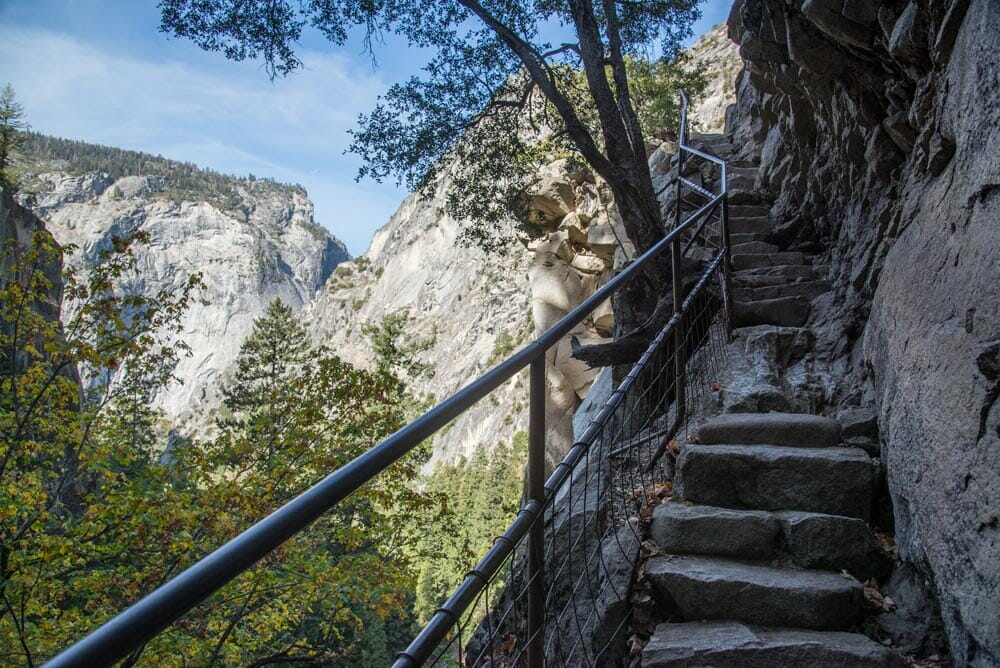
Columbia Rock Hike
Total Distance: 3 miles
Elevation Change: 1000 feet
Difficulty Rating: Moderate
This short hike with lots of steep switchbacks is considered moderate, requiring a decent level of fitness to reach the viewpoint known as Columbia Rock.
Located along the Upper Yosemite Falls trail, about a third of the way in it showcases 180-degree views from the Cathedral Spires to the west and Half Dome in the east.
A sign at the bottom of the trail explains more about the route that was laid out in the 1870s, including the stone steps shaded by the forest. While you won’t see Upper Yosemite Falls on this trek, keep an eye out for the graceful waterfall that spills down the cliffs and drains into a small basin on the east side of Eagle Peak. During late spring and early summer, some colorful wildflowers are likely to come into view as well.
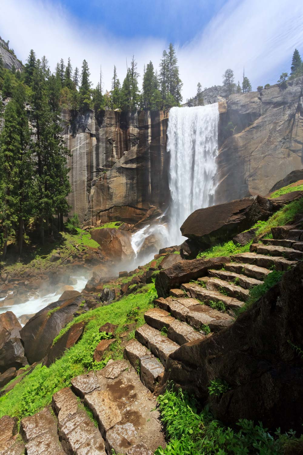
Hiking The Mist Trail
Total Distance: 3 miles
Elevation Change: 1000 feet
Difficulty Rating: Moderate
This is the trail that will bring you to up-close views of Vernal Fall as well as unique views across Yosemite Valley. The first mile is paved and busy, nearly entirely uphill, and leads to the Vernal Fall Footbridge.
Continue on the Mist Trail another half-mile following the steep granite stairway that requires a bit of lung power, watching your footing cautiously due to the heavy spray of the waterfall, especially in spring and early summer.
Along the way will be jaw-dropping views of Vernal Fall, and if the sun is out, you’re likely to see a rainbow develop in the mist. When you reach the top, you’ll be able to peer down the entire length of the rushing 317-foot waterfall before making your descent back.
Hiking The 4-Mile Trail
Total Distance: 9.6 miles
Elevation Change: 3200 feet
Difficulty Rating: Strenuous
Yosemite Valley offers plenty of challenging day hikes as well, like the 4-Mile Trail that while strenuous, provides the more adventurous hiker with views of Yosemite Valley and Yosemite Falls along with a stunning backdrop of the Sierra mountain peaks and Half Dome.
The trail climbs from the valley floor near the Swinging Bridge to the south valley rim at Glacier Point. Here, hikers can grab an ice cream as a reward for all that hard work.
Many adventurers arrange for a ride from the parking lot back to Yosemite Valley from here, but you can make the return by reversing the route, just keep in mind that hiking it round trip takes six to eight hours.
Photography tip: The 4-mile trail is one of the best spots to get photos of the Yosemite Firefall in February!
Pohono Trail in Yosemite Valley
Total Distance: 13 miles
Elevation Change: 3700 feet
Difficulty Rating: Strenuous
A great trek for the serious Yosemite hiker is the Pohono trail. This east-west route travels the south rim of Yosemite Valley from Glacier Point to Tunnel View. It showcases nearly everything the Valley is famous for, though it can only be accessed when Glacier Point Road is open; usually from around mid-May through early November.
As with many hikes in Yosemite, the earlier you go in the season the better, with waterfalls flowing at their peak.
You’ll be able to take in all the iconic natural landmarks, passing Glacier, Taft, Crocker and Inspiration Points, Sentinel Dome and Tunnel View as well as Vernal, Yosemite, Bridalveil and Nevada falls, El Capitan, Half Dome and more, with occasional glimpses of the valley in between.
It’s going to be a difficult climb for at least a mile starting out, although it does get easier as it progresses. While the super-fit, meaning athletes-in-training, can do this trail round trip in a day, most make this a one-way adventure requiring transportation at the end of the hike.
Snow Creek Trail in Yosemite Valley
Total Distance: 9.4 miles
Elevation Change: 2700 feet
Difficulty Rating: Strenuous
This classic but tough hike can be accessed from the Mirror Lake trail head in Yosemite Valley. Similar to the Upper Yosemite Falls trail but narrower and with a faster vertical climb, it’s especially punishing for about a 1.7-mile stretch with lots of switchbacks. The switchbacks lead to iconic Yosemite views across Tenaya Creek Canyon all the way to Half Dome
You’ll pass Mirror Lake early on before getting a distant view of lesser-known Hidden Falls while ascending the trail. The route generally sees little traffic, especially compared to other trails in the valley, while also providing good views of granite land forms like Half Dome and Clouds Rest.
The views become increasingly more impressive the higher you climb.
Upper Yosemite Falls
Total Distance: 7.6 miles
Elevation Change: 2600 feet
Difficulty Rating: Strenuous
This steep hike has been called the ultimate StairMaster workout – the equivalent of climbing the Empire State Building twice, but the views you get won’t be what you’d find in a fitness center or in Manhattan.
One of the oldest trails in Yosemite, built in the 1870s, it leads to the top of Yosemite Falls, North America’s tallest waterfall.
The arduous trek is well-worth the magnificent views at the top, which includes Yosemite Valley, Half Dome, Sentinel Dome and many of its iconic natural land forms.
While the trail is open year-round it’s the most awe-inspiring in the spring when the falls are so powerful, you’re likely to get wet from the spray while getting unique perspective of the surrounding granite. From the top, you’ll even have the opportunity to photograph both Half Dome and Yosemite Falls in the same frame.
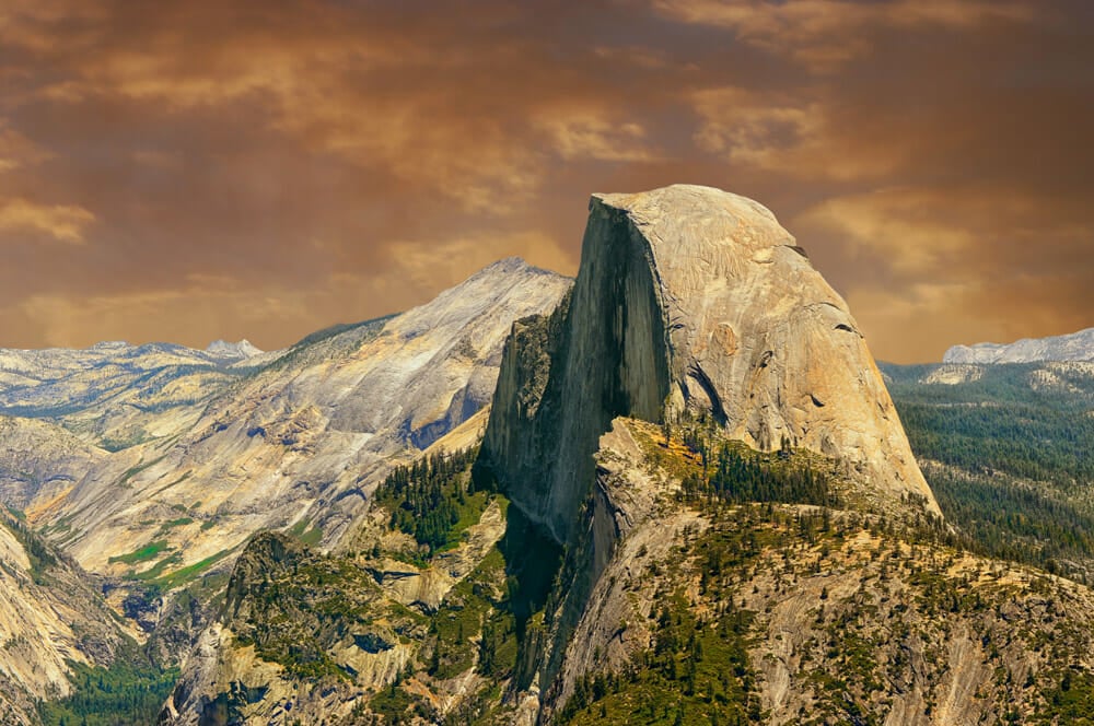
Half Dome (14 – 16 miles, Strenuous, △ 4,800 feet)
Total Distance: 14-16 miles
Elevation Change: 4800 feet
Difficulty Rating: Strenuous
Half Dome is a bucket-list hike, or climb, deserving a category all its own, attracting outdoor enthusiasts from across the globe. Just looking at it is sure to take your breath away, noted by renowned naturalist John Muir as “the most beautiful and most sublime of all the wonderful Yosemite rocks.”
Half Dome is one of the most popular hikes in Yosemite, and the breathtaking trek deserves it’s own introduction. Read about getting permits and hiking half dome here.
Exploring Yosemite Valley
The valley itself is approximately one-mile wide and seven-miles long. Enveloped by glacier-carved granite walls and dotted with waterfalls, the valley is what most people envision when they hear about Yosemite.
It’s here you’ll find the most iconic sights like Yosemite Falls, which cascades down from 2,425 feet above. And the famous view of Half Dome.
For park visitors, highlights of Yosemite Valley include: Yosemite Village, Yosemite Museum, the Ansel Adams Gallery, eateries, a grocery store and gift shops. You can also spend the night in Yosemite Valley’s campgrounds and motel rooms.
The Best Time Of Year To Hike Yosemite Valley
The question as to when to visit really depends on what you’re looking for in your hiking experience. The park is open 365 days of year, but spring may be the best time of all with everything coming to life.
During spring, dogwoods will be in bloom, the animal babies make their debut and the waterfalls will be flowing at their peak. The big crowds of summer have yet to arrive, which means no worries about bumping elbows out on the trail. And you might even be able to glimpse lunar rainbows that appear in the mist around the base of Lower Yosemite Falls on a clear, full moon night.
Summer is peak tourist season, bringing the majority of the four million visitors that arrive each year, with the Valley rather chaotic and long lines even out on the trails. By mid-summer, afternoon temperatures are sizzling and many of the waterfalls dry.
During autumn, visitors start to diminish and vibrant foliage transforms the landscape starting around mid-October.
Winter is a quiet time in the park. While many trails will be icy or covered with snow, they can be ideal for snowshoeing through magical wonderland with frozen falls and snowy peaks.
What To Pack For Hiking In Yosemite Valley
What to pack and wear out on the trail depends on the season, with spring and fall often bringing a mixed bag that requires both warm and cool weather attire. Dress in layers that can easily be removed or put on while hiking.
Early mornings and nights can be quite chilly, requiring a warm, waterproof coat. In the summer, it’s likely to be quite warm throughout the day but you’ll still need a sweatshirt or light jacket for evenings.
Winter means bundling up in cold weather gear, including warm, waterproof boots, warm coat, gloves and hat.
Getting To The Yosemite Valley Trails
Tunnel View Outlook, El Capitan (one of the largest granite monoliths on the planet) Vernal Fall, Bridalveil Fall, Nevada Fall, Yosemite Falls and Half Dome trails can all be hiked from Yosemite Valley. The east end of Yosemite Valley is where you’ll find the majority of trailheads.
Hiking trails in and around the valley can easily reached by taking the free Yosemite Valley Shuttle.
The shuttle makes 19 stops past park stores, trails and all the overnight accommodations and major viewpoints. It loops by every 20-30 minutes and operates from 7 a.m. to 10 p.m. throughout the year. The shuttle is a hop-on hop-off bus so you don’t need to worry about grabbing tickets or scheduling routes beforehand.
During the busy summer season, it’s much easier to get around on the free shuttle than it is to drive. Vehicles are discouraged in this part of the park to prevent pollution and traffic.
Comments (0)